

Parsian Offshore Gulf Survey furthermore expertise in conducting geophysical surveys and seabed mapping projects for non oil and gas applications. Principal among these are the following:
• Hydrographic surveys to update nautical charts required by coastal states
• Pre-dredged and Post dredge bathymetric surveys
• Geophysical surveys to support marine renewable energy developments such as Offshore Windfarms and Tidal power generation projects
• Submarine telecom and power cable route surveys
Parsian Offshore Gulf Survey has a long track record of collecting bathymetric data, using the latest Multi-Beam Echo Sounders (MBES), whether it be ROV-based or over-the-side pole-based systems. Offshore applications such as trenching (pre-cut, pre-lay, post-lay and intermediate surveys), dredging (pre, post and real-time surveys), sonar/acoustic pipeline inspection, site surveys, or any requirement for a map of the seabed, can be supported with a suitably designed mapping system.
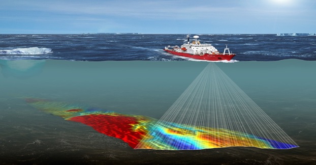
Using versatile, flexible sensors and software we can provide customers with specialized system set-ups, covering everything from vessel navigation systems, subsea positioning, ROV instrumentation, digital video recording systems, tidal corrections and time synchronization needed to gather high quality data.
PARSIAN OFFSHORE GULF SURVEY specializes in providing systems that can be used on a wide range of platforms, with short mobilization time and are capable of doing the necessary calibrations and verification processes to provide a well-integrated system. PARSIAN OFFSHORE GULF SURVEY listens to our clients’ needs and requirements, and deliver data in most known data formats, whilst also providing support with interpreting data.
General Services
Several of the supporting services Parsian Offshore Gulf Survey provides are common to many project types. For accurate vessel and subsea positioning, a well calibrated vessel survey gyro and USBL system is essential. Parsian Offshore Gulf Survey experienced personnel provide a range of well-established and proven services to complement our other services: These general services include:
- Quayside vessel gyro and motion sensor calibrations
- USBL calibrations
- Dimension control surveys, including offset measurements
- DGPS verifications
- Reporting (data processing and reporting)
- Geodetic consultancy
- CAD and GIS
- Video recording for documentation